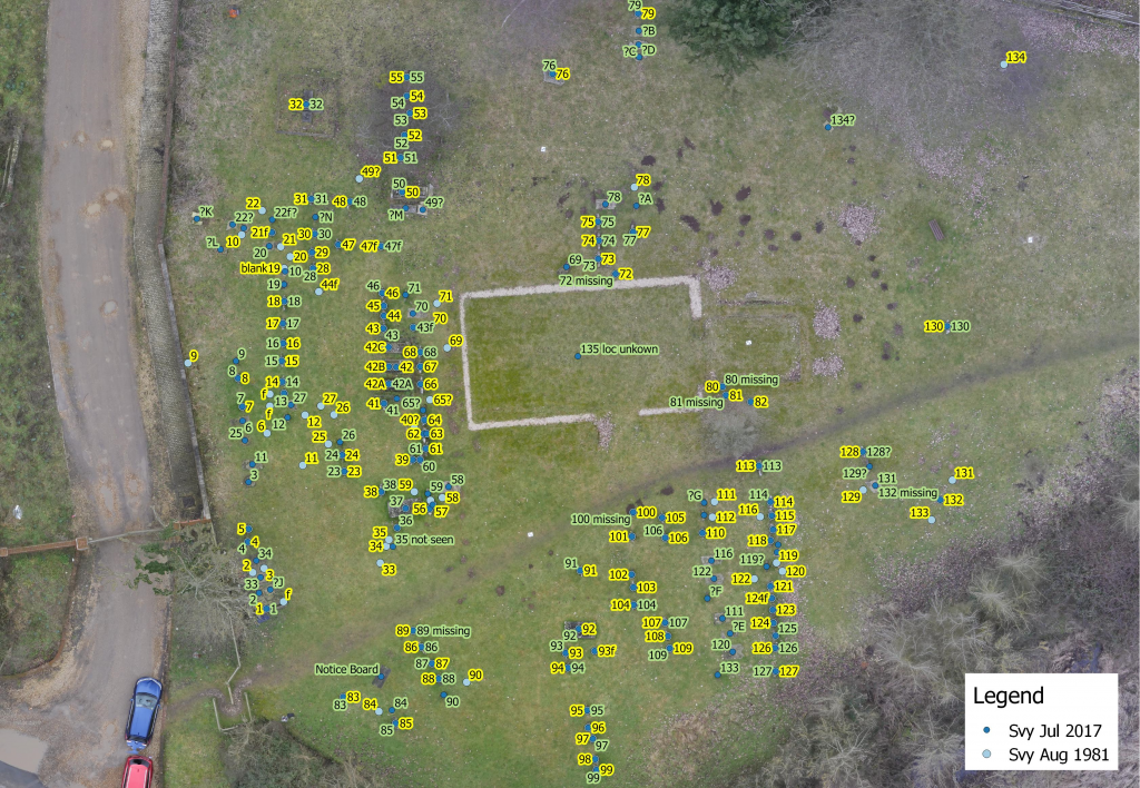
For this GIS case study example, the Client is a village conservation group who maintain the graveyard of the village medieval church that fell into disuse and was eventually demolished.
Numerous burial records exist in paper form and several surveys have been carried out to match names with headstones and burial plots. A.D.S. & Associates assisted in reconciling the various documents and producing a visual plan of the graveyard.
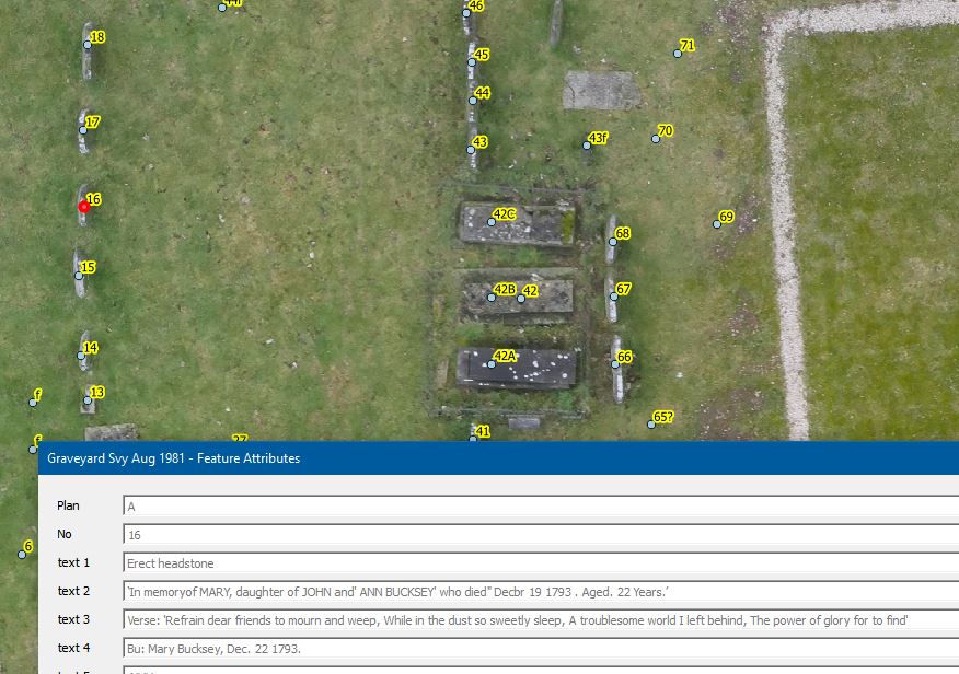
A searchable database was created from the reconciled data and an aerial survey carried out to record the locations of the headstones and remaining grave plots. The records were matched with the aerial survey.
The database is now available to the group using an online GIS platform with a view to allowing access to descendants and the general public.